
Satellite imagery API: Why Satellite imagery API?
Posted on 19 Sep 2018
Why the Satellite imagery API?
In the past, it was not easy to work with satellite imagery and use the images in applications. You had to have deep expertise in the satellite imagery area and have access to massive computing capacity. Fortunately, now this data is available in a much easier way through our APIs.
Our platform performs a significant and complicated job to let you get images for your application. We collect, store and process open images of Landsat 8, Sentinel-2 and Modis, and images from commercial providers. We keep them in the unified format with the unified level of brightness. As a result of this background job, you simply call data for your polygon for a chosen date or period and get smooth, non-stitched images of high resolution and quality that are made up of images from different satellites (we pick up the best images with a different resolution, to produce better results). You also get metadata for the polygon or any pixel.
The Satellite Imagery API is a fast and simple way to work with satellite imagery. You can call the API from your agricultural application and get images for your polygons in near real time. You can get prompt access to vast archives of imagery and use them for your machine learning algorithms.
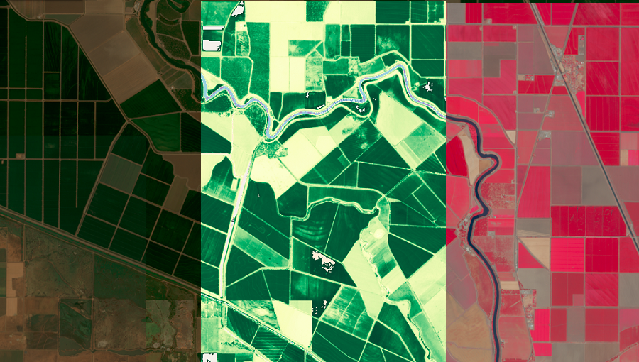
With our powerful platform, we process data on the fly and return images as True colour and False colour channels, and also in the form of calculated NDVI and EVI indices.
How to set up your polygon and get its ID
Before you start requesting satellite imagery or any other data, you need to set up a polygon using the Polygons API and get its ID. You can then use this polygon ID to call the API for satellite imagery, as well as calling all other APIs for weather, accumulated temperature, soil moisture and other data. We store all your polygons in our system, and you can use the Polygons API to edit your polygons, delete them or add new ones.
How to work with the Satellite Imagery API
So, now that you have your polygon ID, you can call the Satellite Imagery API in two simple steps:
-
Search for satellite imagery for a polygon. We search all available satellite imageries for your polygon and return the URLs to you (True Colour, False Colour, NDVI and EVI). Use these URLs in Step 2.
-
Get satellite imagery and metadata. We have four groups of APIs to get an image of your polygon in PNG, a tile in PNG format, statistics and metadata for the NDVI and EVI indices of a polygon, and the image in GeoTIFF format. Using the URLs from Step 1, call the APIs using the “image”, “tiles”, “stats” or “data” field respectively.
In future articles in this series, we will tell you about getting images and metadata (Step 2 above) in more detail.
Please also see: Visualisation of the NDVI index on satellite maps. Custom palettes for agricultural applications