
A visual and feature-rich API that gives you weather map tiles for any global location
Posted on 19 Nov 2021
With the global mobile app market valued at over $170billion, both independent developers and those developing for enterprise solutions are constantly on the search for unique ways to improve their product’s look, performance, and appeal. Users increasingly expect a high degree of accuracy, versatility, and depth to the information they receive through their devices.
Giving users a visual display of the weather in their area can enrich their app experience, and provide them with valuable information at their fingertips.
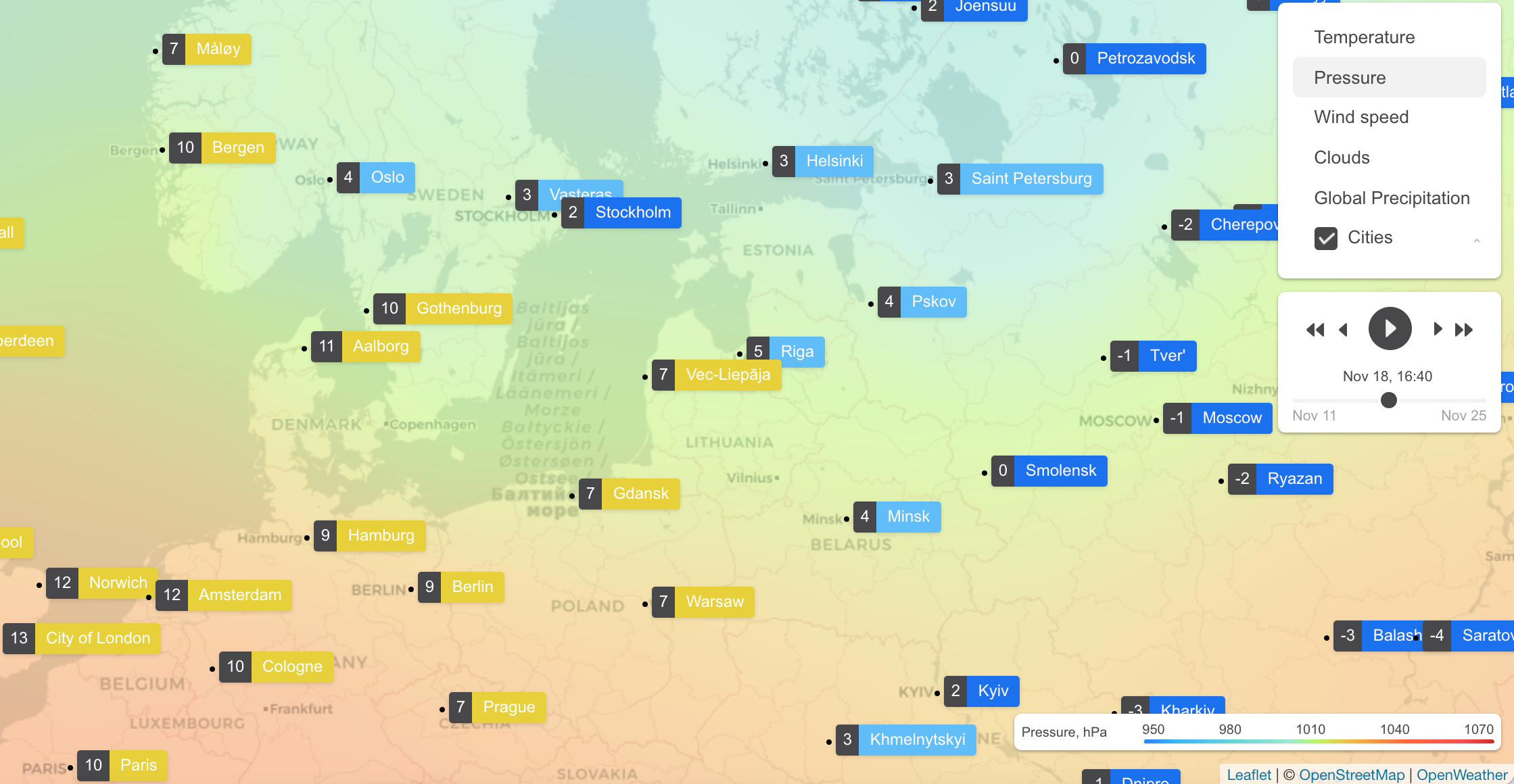
The OpenWeather Weather Maps 2.0 with 1-hour step API provides fourteen different types of weather map layer overlays for both forecast and historical data, anywhere in the globe. With forecast data reaching up to 4 days, and historical data reaching back twelve months, this single-call API provides an easy-to-use way to provide mapping information for a wide range of uses.
With global travel restrictions being eased, voyagers are starting to plan their journeys; For the winter sports enthusiasts, the accumulated snow precipitation and snow depth layers give the ability to plan their long-awaited journeys to the slopes. And for those who prefer their adventures on two wheels, the precipitation intensity level can warn any cyclists of potential downpours that might spoil their rides.
Those developing for the agriculture industry might make use of the soil temperature options that are available at both 0-10cm and >10cm depths, giving arable farmers a critical insight into managing their crop rotation schedules. The relative humidity and air temperature layers can help dairy farmers manage the stress that weather conditions can cause their herds.
This versatile API gives developers the option to use a default colour palette or define their own, as well as up to 17 different zoom levels, and time accuracy to within an hour.
To gain access to the OpenWeather Weather Maps 2.0 with 1-hour step API, simply contact our sales team, who will be happy to explain how to give your API key access. If you do not already have an API key, one can be obtained here.
Making the API call cannot be easier, these are the parameters you would need:
-
Code of the weather layer.
-
Zoom level.
-
Tile coordinates (please note the tile coordinates are not the same thing as latitude and longitude coordinates).
-
Date and time in Unix format - for the forecast or historical map. If none are specified, you will receive the current weather map.
-
Your API key.
This versatile API also gives you the ability to easily specify your own colour palette for any of the layers, giving your application a unique look and feel. You can set the color for any value with any precision. More details can be found here.
An example of the API request:
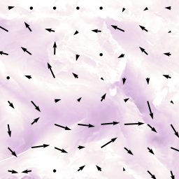
https://maps.openweathermap.org/maps/2.0/weather/1h/WNDUV/4/1/6?appid={API key}
As the API response, you will receive a tile, similar to the one below that corresponds to the parameters that you supplied:
No matter where your interest lies, cattle or carrots, skiing or sailing, you will find that the OpenWeather Weather Maps 2.0 with 1-hour step API will give you valuable and visual insights into the weather at your location.
The maps is supported by all standard mapping libraries like OpenLayers and Leaflet. Please read more here.